With Theta, 2020 sets the record for most named Atlantic storms

It’s official: 2020 now has the most named storms ever recorded in the Atlantic in a single year.
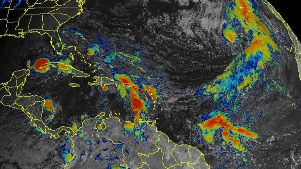
On November 9, a tropical disturbance brewing in the northeastern Atlantic Ocean gained enough strength to become a subtropical storm. With that, Theta became the year’s 29th named storm, topping the 28 that formed in 2005.
With maximum sustained winds near 110 kilometers per hour as of November 10, Theta is expected to churn over the open ocean for several days. It’s too early to predict Theta’s ultimate strength and trajectory, but forecasters with the National Oceanic and Atmospheric Administration say they expect the storm to weaken later in the week.
If so, like most of the storms this year, Theta likely won’t become a major hurricane. That track record might be the most surprising thing about this season — there’s been a record-breaking number of storms, but overall they’ve been relatively weak. Only five — Laura, Teddy, Delta, Epsilon and Eta — have become major hurricanes with winds topping 178 kilometers per hour, although only Laura and Eta made landfall near the peak of their strength as Category 4 storms.
Even so, the 2020 hurricane season started fast, with the first nine storms arriving earlier than ever before (SN: 9/7/20). And the season has turned out to be the most active since naming began in 1953, thanks to warmer-than-usual water in the Atlantic and the arrival of La Niña, a regularly-occurring period of cooling in the Pacific, which affects winds in the Atlantic and helps hurricanes form (SN: 9/21/19). If a swirling storm reaches wind speeds of 63 kilometers per hour, it gets a name from a list of 21 predetermined names. When that list runs out, the storm gets a Greek letter.
While the wind patterns and warm Atlantic water temperatures set the stage for the string of storms, it’s unclear if climate change is playing a role in the number of storms. As the climate warms, though, you would expect to see more of the destructive, high-category storms, says Kerry Emanuel, an atmospheric scientist at MIT. “And this year is not a poster child for that.” So far, no storm in 2020 has been stronger than a Category 4. The 2005 season had multiple Category 5 storms, including Hurricane Katrina (SN: 12/20/05).
There’s a lot amount of energy in the ocean and atmosphere this year, including the unusually warm water, says Emanuel. “The fuel supply could make a much stronger storm than we’ve seen,” says Emanuel, “so the question is: What prevents a lot of storms from living up to their potential?”
A major factor is wind shear, a change in the speed or direction of wind at different altitudes. Wind shear “doesn’t seem to have stopped a lot of storms from forming this year,” Emanuel says, “but it inhibits them from getting too intense.” Hurricanes can also create their own wind shear, so when multiple hurricanes form in close proximity, they can weaken each other, Emanuel says. And at times this year, several storms did occupy the Atlantic simultaneously — on September 14, five storms swirled at once.
It’s not clear if seeing hurricane season run into the Greek alphabet is a “new normal,” says Emanuel. The historical record, especially before the 1950s is spotty, he says, so it’s hard to put this year’s record-setting season into context. It’s possible that there were just as many storms before naming began in the ‘50s, but that only the big, destructive ones were recorded or noticed. Now, of course, forecasters have the technology to detect all of them, “so I wouldn’t get too bent out of shape about this season,” Emanuel says.
Some experts are hesitant to even use the term “new normal.”
“People talk about the ‘new normal,’ and I don’t think that is a good phrase,” says James Done, an atmospheric scientist at the National Center for Atmospheric Research in Boulder, Colo. “It implies some new stable state. We’re certainly not in a stable state — things are always changing.”